Select Page

Building Ventures That Move Trade, Land, and Agriculture Forward

Alfa-Trading Overview

Alfa Trading is a trading venture built by Tim Alfa Teknoversa, focused on bridging agricultural supply chains with efficient, transparent, and scalable trade systems. Designed to operate independently within the ecosystem, Alfa Trading facilitates the distribution of agricultural inputs, raw commodities, and value-added derivative products such as biomass, palm derivatives, and organic by-products.

Agriculture-Technology

Agrilabs is an agritech, specializing in the use of AI and remote sensing technologies to transform how farmers manage their land and inputs. By analyzing satellite imagery, geospatial data, and machine learning models, Agrilabs delivers precision insights that help farmers make smarter, faster, and more sustainable decisions.


Alfa Geo-Solution

Alfa Geo-Solution is a geospatial intelligence venture built by Tim Alfa Teknoversa, offering integrated services in mapping, spatial analysis, remote sensing, and field verification for sectors such as urban, infrastructure, and environmental monitoring. By combining satellite imagery and geospatial data with on-ground field services—including ground truthing and technical assessments—Alfa Geo-Solution delivers accurate, actionable insights that help clients make data-driven, impact-conscious land-use decisions.

Biomasses

Renewable energy sources made from agricultural and forestry residues, such as wood pellets and rice husk pellets. These sustainable fuels are used for industrial heating, power generation, and carbon-neutral energy solutions.

Spices

Premium-grade Indonesian spices known for their rich aroma and flavor. Sourced from traditional farms, our cloves, nutmeg, and cinnamon are widely used in food, beverage, cosmetics, and pharmaceutical industries.

Coconut Products

Versatile coconut-derived products including semi-husked coconuts for food processing and coconut shells for charcoal and crafts. Harvested sustainably and suited for both raw export and value-added industries.

Trading goes beyond moving goods—it connects producers to global markets and unlocks economic value. By linking agricultural supply with demand, it empowers farmers, drives efficiency, and opens pathways for sustainable growth. From spices to biomass, trading turns local commodities into global opportunities.

Nutrient Mapping

High-resolution nutrient mapping technology that analyzes palm oil plantations using AI and remote sensing. This service provides data-driven insights into soil fertility and nutrient variability, enabling targeted and efficient field interventions.

Smart Fertilizer Recommendation

Precision-driven fertilizer planning that combines geospatial data, AI, and agronomic models to recommend optimal nutrient blends. Helps reduce input costs, minimize environmental impact, and boost productivity for each plantation block.

Yield Prediction

AI-powered yield forecasting system that leverages satellite imagery, field data, and historical trends to predict harvest outcomes. Supports plantation managers in planning logistics, managing resources, and maximizing revenue with greater accuracy.

Agritech is redefining how food is grown—turning traditional farming into a data-driven, precision-based system. By combining AI, remote sensing, and biotechnology, it helps farmers boost productivity, use fewer resources, and adapt to climate challenges. Agritech turns everyday farm activities into smarter, more sustainable decisions that power the future of agriculture.

Survey Services

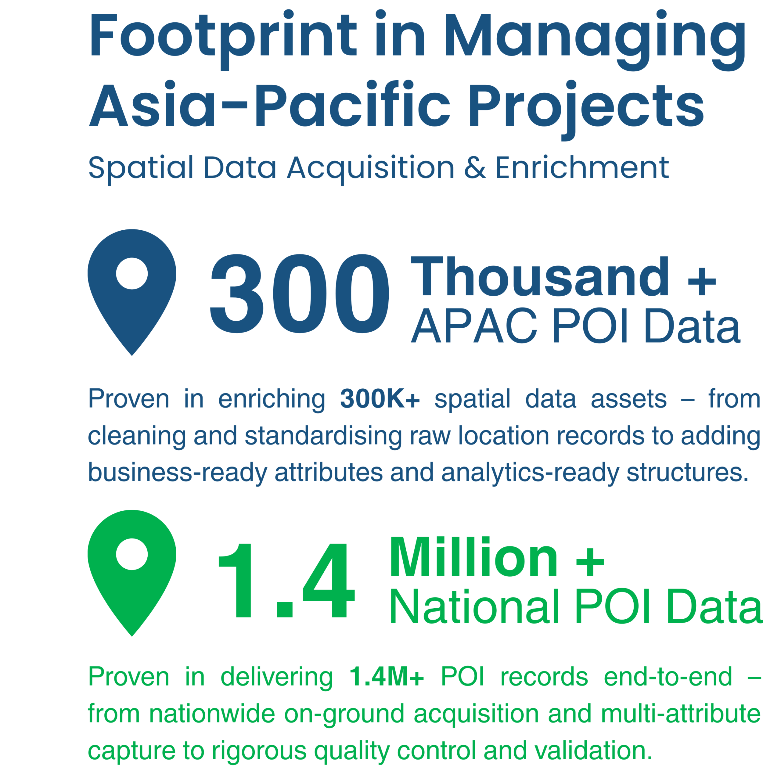
Comprehensive land and field survey services focused on building accurate Point of Interest (POI) datasets using GPS, drones, and ground validation. Ideal for transportation planning and digital infrastructure development, our surveys deliver precise spatial insights to support smart mobility, logistics, and digital mapping systems.

Mapping Services

Detailed geospatial mapping solutions that visualize land cover, boundaries, and terrain. Using satellite imagery and GIS technology, our maps support better planning and decision-making across plantations, urban areas, and natural resources.

Consulting Services

Expert advisory services in geospatial analysis, agronomy, and land-use planning. We help clients interpret spatial data, optimize land productivity, and implement sustainable practices tailored to their operational goals.

Geo solutions bring clarity to the land—transforming satellite data, mapping, and field surveys into actionable insights. From agriculture to infrastructure, they help decision-makers understand terrain, monitor change, and plan with precision. By bridging the gap between location data and real-world impact, geo solutions enable smarter, faster, and more sustainable land-use decisions.

Jakarta Office (HO)

DAvenue Office Space

Jl. Teratai No. 4, Tanjung Barat, Jagakarsa 
South Jakarta 12530 – Indonesia

Surabaya Office

Jl. Bogangin 1B, No. 62, Kedurus, Karangpilang, Surabaya 60221 – Indonesia

Email

adilla@timalfa.com

Phone

(+62) 21 782 8770